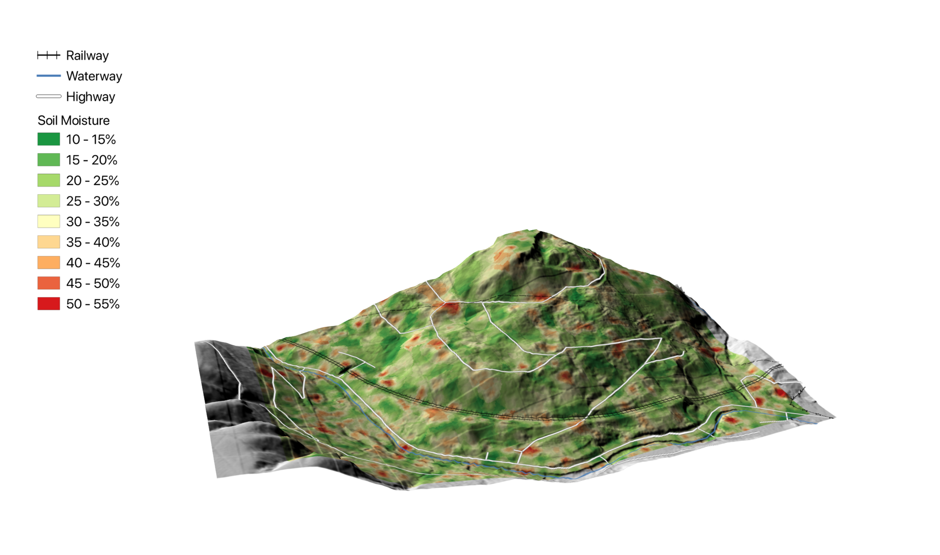
Central Alliance is pleased to announce its revolutionary new product, used for mapping ground saturation from space.
Groundsat powered by Utilis, is an innovative new technology, developed by Central Alliance Applied Technologies, and used to measure soil moisture levels below ground. The technique maps ground saturation, enabling an assessment of sites with regards to potential geotechnical instability and drainage problems, to proactively identify at risk locations. This allows investigation and inspection to be focussed on the most at-risk areas, before they have an impact on critical infrastructure, construction projects and development sites.
The assessment is provided graphically as a “heat map”, based on a sub-soil water content analysis undertaken on data from a satellite, processed by Utilis’ algorithm and presented as a 3D model to allow the context of topography and other pertinent features to be considered.
In addition to identifying high risk locations, Groundsat provides data that facilitates the assessment of climate change impact on infrastructure resilience, as well as identification of third-party impacts on a site. Other significant benefits include:
- Fully remote assessments of sites
- A snapshot of saturated ground and potential leaks
- The ability to penetrate vegetation and ‘see’ into the ground
- No adverse effects from local weather conditions
- Water is identified directly – not the effects of water
- Further advantages for geohazard identification, particularly when combined with other data sets such as digital elevation models
- Much greater areas can be monitored using satellite imaging, without the time and resource associated with the traditional methods of field-based inspections and surveys.
For more information about Central Alliance, its partnership with Utilis Corp., or its remote satellite technology services, please call 01924 229 889 or email [email protected].
